Tillbridge-specific FAQs
Why is Tillbridge Solar needed?
The UK has set ambitious climate change targets to achieve net zero carbon emissions by 2050 and to ensure that the energy supply remains secure, reliable, and affordable. Together with legally binding commitments such as these, the government has further set out how the deployment of renewable technologies such as wind, nuclear, solar and hydrogen will be accelerated in its latest Energy Security Strategy.
In this strategy, a key aim is to increase the UK’s solar capacity five-fold by 2035, which would increase the total generation capacity from 14 gigawatts (GW) today to around 70GW in the future. Tillbridge Solar would make a significant contribution towards achieving these targets and help provide a reliable source of affordable energy.
The release of Powering Up Britain (March 2023) marked a clear statement from the Conservative Government on its commitment to making net zero a reality and reiterated the need to maximise deployment of both rooftop and ground-mounted solar to achieve national targets.
Tillbridge Solar would connect into the National Grid at Cottam Substation. The decommissioning of the previous coal-fired power station on this site has provided additional spare grid connection capacity and the opportunity for the region to play an important role in renewable energy generation in years to come.
How big will the Scheme be?
Tillbridge Solar has an offer from National Grid to access up to 500MW of grid connection capacity, meaning that up to this amount of renewable energy generated by the Scheme can be exported to the National Grid at one time. We continue to listen to feedback and are working to develop a Scheme that provides the best and most efficient solution and allows the Scheme to provide as much renewable electricity within these constraints.
The 2,700-hectare site was refined and reduced through a master planning exercise reducing the development area to approximately 1,400 hectares. Of this, 900 hectares would be developable area (for panels and other infrastructure) and 400 hectares would be a non–developable area (land considered for mitigation and ecological enhancement).
Our ongoing technical and design work, together with our early-stage engagement and collaboration, would help determine the size of the Scheme, how much land would be needed to host solar panels and associated infrastructure, and where would go. You can see the initial plans in the interactive map, which is available here.
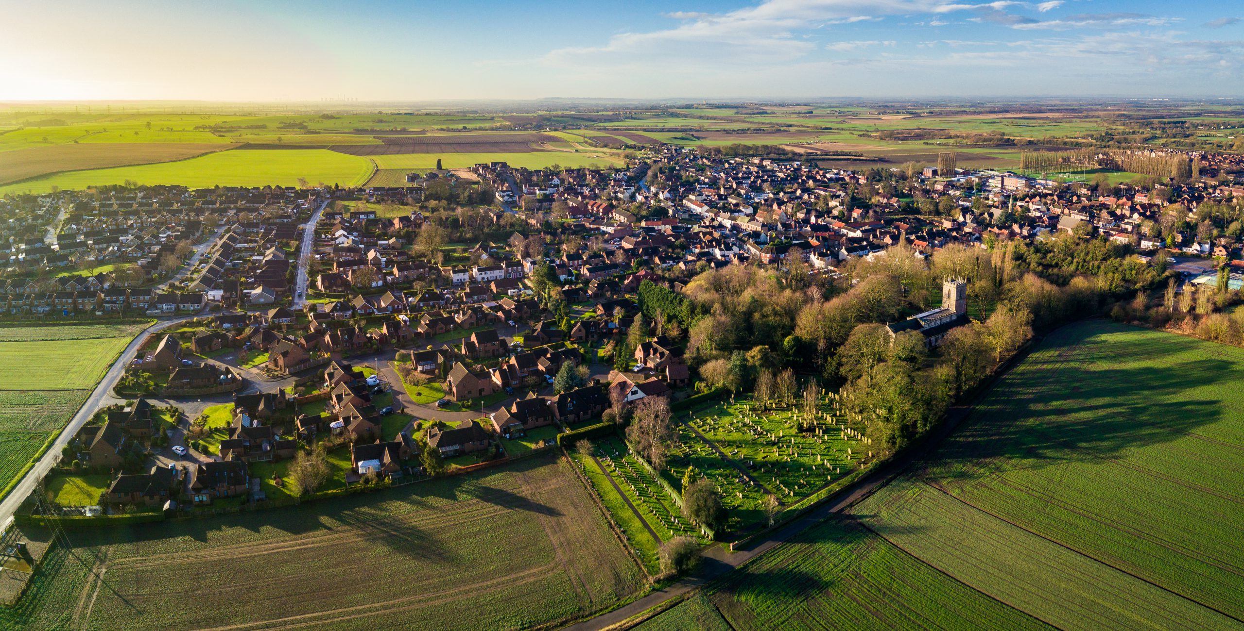
Where is the Scheme located?
In the early stages of the Scheme, we identified an initial area of search for the location of a proposed solar energy farm, which could generate more than 50 megawatts (MW) of electricity in the east of England. The east of England was chosen due to the availability of grid connections, and irradiance.
We then considered previously developed land, lower grade agricultural land, ecology and biodiversity, landscape and visual considerations, the historic environment and access/transport. This work has led to the identification of the current site – land to the south, east and south-east of Gainsborough, and to the north-west of Lincoln.
We have provided indicative preferred areas for development, including where the solar panels, underground cabling, and other project infrastructure would be located. These areas are identified as ‘developable’ areas on the map on our website.
We have also identified indicative ‘non-developable’ areas, which are areas that would be considered for mitigation (such as tree planting and landscaping), but would not be used to host solar panels or associated infrastructure.
These areas have evolved over time following a desk-based site search exercise which has considered environmental, planning and operation constraints (such as the grid connection at National Grid’s Cottam Substation).
We have also now identified a search area for our Cable Route Corridor, where the underground cables would be located. This corridor is a broad area of land through which an electrical connection (from the PV panels to the National Grid) could be located and will vary in width.
We continue to refine our plans to ensure minimal environmental and social impact.
Given other solar projects in Lincolnshire, why is Tillbridge Solar situated here?
The decommissioning of EDF Energy’s Cottam Power Station in 2019 freed up around 2,000MW of generating capacity in this area of Lincolnshire. Tillbridge Solar would play an important role in replacing this former generation capacity and supporting the region’s transition to producing more renewable energy.
The availability of grid connection in this area, together with our site selection exercise, has helped to identify preferred areas for development, based on a number of environmental and planning factors.
We are aware there are a number of other proposed solar developments in the area. Lincolnshire is fast becoming the UK leader in solar energy, playing an important role in the transition away from relying on coal and imported oil and gas, towards home-grown renewable energy that ensures self-sufficiency. However, we understand that the rate and pace of different projects may cause uncertainty for some about the impacts these projects will have for local communities.
Tillbridge Solar is a responsible developer and wishes to work with the local community to ensure that its projects cause as little disruption as possible for local people. This will help us understand how these projects can be delivered collectively and efficiently, whilst reducing potential cumulative impacts to local communities.
We have been and will continue to work constructively with other developers to make sure that local residents are fully informed about each of the different solar proposals. Our discussions so far have also centered around cable route installation, to ensure as little disruption to the local community as possible.
What benefits are there for communities?
Tillbridge Solar is committed to ensuring that local communities can benefit from the project. Our engagement will be important in helping us to understand what local schemes or projects could be supported to benefit communities located closest to the project.
We are currently investigating how a community benefit fund could be managed and delivered independently. One way of doing this is by appointing a community foundation who would independently manage the fund on our behalf. We have spoken with Lincolnshire Community Foundation and Nottinghamshire Community Foundation, who would be able to use their local knowledge and experience to identify funding opportunities and help maximise benefits for local communities.
We’re inviting your continued views on how such a benefit could be made available through our Scheme and how it could be administered and managed. We also continue to welcome any suggestions for local Schemes and initiatives that we could support.
What is the impact on agricultural land in the area?
We will be submitting a final Agricultural land classification (ALC) survey as part of our final DCO application, which will determine the grading of land within our Principal Site. A desk-based baseline ALC assessment of the Cable Route Corridor will also be undertaken.
To date, we have been able to survey approximately 1,200 hectares of our Principal Site (which is approximately 1,400 hectares in total). These surveys show that approximately 82% of the Principal Site is classified as ‘grade 3b’ agricultural land, and approximately 4% is classified as ‘grade 3a’, with approximately 14% of the Principal Site yet to be surveyed. An assessment outlining these findings is provided within the Socio-economics Chapter; Chapter 14 (Volume 1) of the Preliminary Environmental Impact Report with the Interim ALC report provided in Appendix 14-2 (Volume 2), provided as part of this consultation. A full assessment and ALC report will be available as part of our DCO application.
What is the impact be on the landscape?
Landscape effects, i.e. those which occur to features or characteristics of the landscape, will be significant within the Principal Site area, due to the long-term presence of solar infrastructure. However, these will be balanced against an increase in and improvement to the condition of features and habitats such as trees, hedgerows, woodland and species-rich (meadow) grasslands.
Some significant visual effects, i.e. those on people’s views, will arise for some residential properties near the site and roads or footpaths where there are open views (such as Middle Street along The Cliff). However, the inclusion of mitigation screen planting is intended to limit the majority of these visual effects as vegetation matures over time. In particular, we will look to reduce effects from the green space and Scheduled Monument at Harpswell. Opportunities for planting in advance of the scheme construction will also be explored.
Landscape and visual effects are not expected to be significant for the cable corridor. This route will be designed to avoid sensitive landscape elements and views; and any removed vegetation that requires removal will be replaced wherever possible.
What is the impact on public rights of way?
The Scheme design will look to avoid the closure or diversion of public rights of way. The preferred site area does not contain any public rights of way.
The impacts of the Scheme on public rights of way has been assessed as part of a socio-economics and land use assessment, and can be seen in Chapter 14 of PEI Report.
What is the impact on archaeology?
In terms of buried archaeology, any disturbed assets would be recorded and evaluated during the construction phase. At this stage, we have not identified any particular issues with buried archaeology. Additional survey work is being undertaken and results will be reported when we submit our Environmental Statement.
In terms of built heritage, in most cases, the Scheme would have limited effects on the setting of built heritage assets as existing vegetation and ground level differences would obscure views of the Scheme from those assets.
However, once operational, solar infrastructure may be visible from the scheduled monument of Harpswell Hall and the grade I listed Church of St Chad. New planting has been included in the landscape design to mitigate effects and the potential for further landscaping will be investigated further, prior to submission of the ES with the DCO application.
How long will it take to build?
Tillbridge Solar is subject to being granted development consent from the Secretary of State for the Department for Energy Security and Net Zero. Should the Scheme be granted consent, construction could start as early as autumn 2025. We anticipate that it would take two years to build, with the site potentially being fully operational and generating electricity from 2027.
How long will Tillbridge Solar be in operation?
The Scheme is expected to generate clean energy for approximately 40-60 years, with decommissioning expected to commence thereafter.
How will energy be stored?
In addition to the electricity transferred to the National Grid, Tillbridge Solar would also include an on-site energy storage solution. This would ensure that excess electricity generated by the Scheme when demand is low can be stored on site, and then be exported onto the grid when demand is higher.
When will communities be able to have their say on the proposals?
Consultation and engagement with local communities is important to us and forms part of the pre-application process for Tillbridge Solar.
Between 30 May 2023 and 11 July 2023, we are asking for your feedback on our updated proposals. Your feedback will help us to shape our proposals before we submit our application for a Development Consent Order.
You can take part in the consultation in the following ways:
- Attend a public consultation event or an online webinar
- Access our materials at five local information points
- Provide your feedback either online, by email, in writing or by post
You can view more details about the consultation and how to have your say on our Consultation page here.
We encourage anyone with an interest in our proposals to get in touch with any questions they may have. You can get in touch with us using our communications channels, including via email [info@tillbridgesolar.com] Freephone [0800 046 9643] or Freepost [FREEPOST TILLBRIDGE SOLAR].
General Solar FAQs
What is a solar energy farm and how does it work?
Solar energy farms are large-scale solar installations where photovoltaic (PV) panels, referred to as solar panels, are used to harvest the sun’s power. The PV panels convert the solar energy into electricity which is exported to the National Grid via underground cables.
Tillbridge Solar would comprise the construction, operation (including maintenance), and decommissioning of ground mounted PV arrays and supporting infrastructure. The support infrastructure would include:
- Battery Energy Storage System (BESS), allowing electricity generated by the PV panels to be stored on site and released to the National Grid when required
- Solar stations, comprising electrical equipment such as inverters and transformers
- Substations, allowing electricity to be generated and exported to the National Grid
- Access tracks for maintenance and staff car parks
- Security fencing and CCTV
- Landscape planting to screen views, most likely through infilling and planting of hedgerows and trees
- Planting within the PV array area and around the perimeter of the site to help improve the landscape and achieve Biodiversity Net Gain
- Underground cabling connecting the solar farm with National Grid’s Cottam Substation.
Does solar work in the UK?
Solar works well everywhere in the UK. It is radiation from the sun, rather than temperature, heat or direct sunlight, that enables solar PV panels to generate electricity. Solar panels don’t need direct sunlight to operate and produce power all year round, accounting for about 4% of yearly national consumption. In the middle of a day, they can produce over a quarter of the UK’s power.
What is a battery storage facility?
Battery storage, or battery energy storage systems (BESS), enable energy from renewables, like solar and wind, to be stored and released when customers need power most.
How are solar farms installed?
Solar PV panels are installed in rows on the land. Electrical converters take the DC power generated by the PV panels and convert this to AC power – the standard form of electricity for the National Grid. The power is then stepped up to the required voltage and distributed to the grid. A generation meter records the electricity generated and supplied to the grid.
How long do solar panels last?
The Scheme is expected to generate clean energy for approximately 40-60 years. We typically look for options to extend this for another five years (subject to a new planning application), although any extension is up to the landowner.
Does land used for solar farms reduce food security?
Solar farms provide valuable income for farmers; they can still be used for grazing and support UK farmers to continue food production on other parts of their land. Some developers consider growing produce under or alongside solar panels.
How much space do solar farms take up?
Even under 2050 Net Zero targets, Solar farms would occupy 0.5% of the UK’s land – much less than what is currently used by golf courses.