
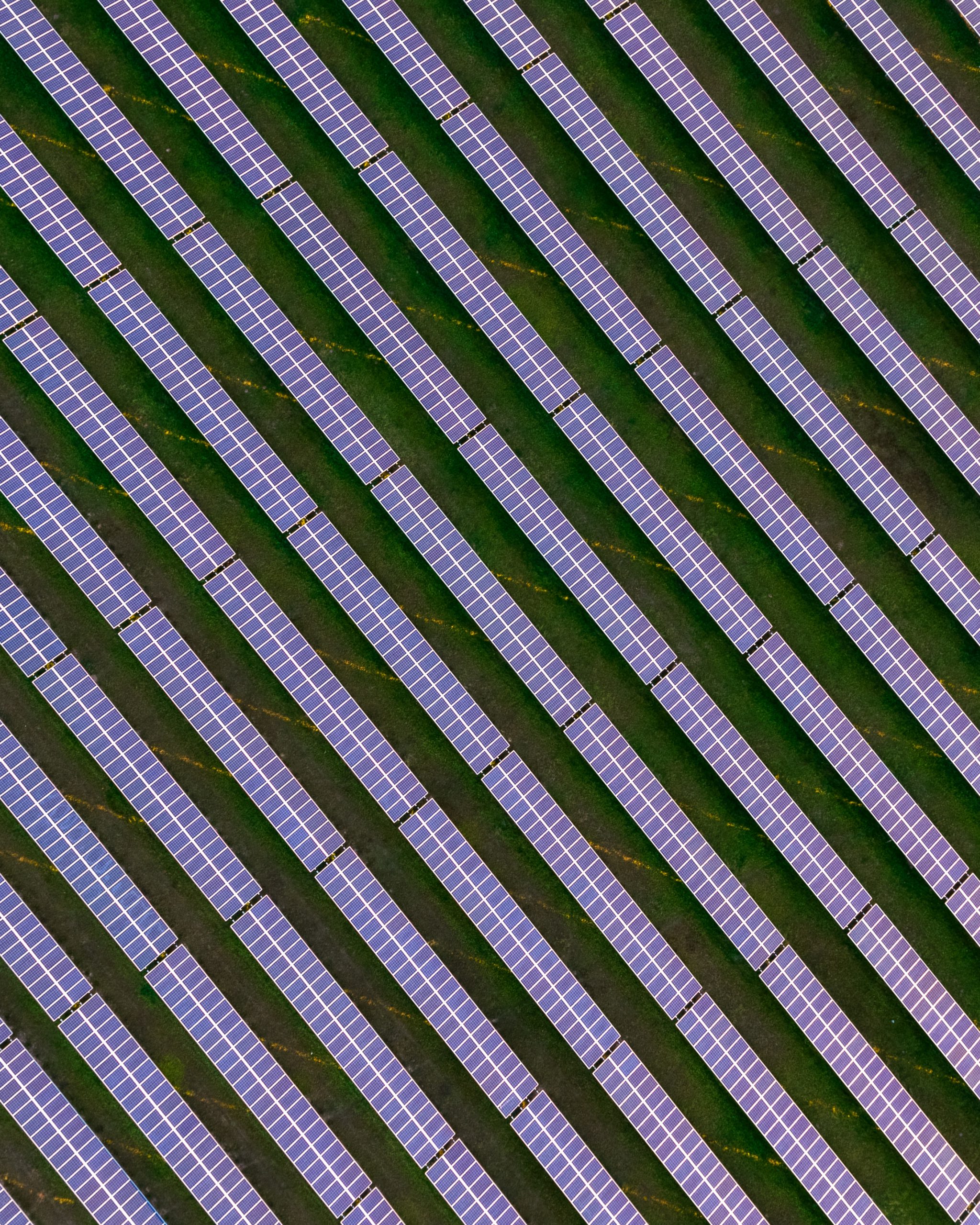
Overview
Tillbridge Solar is a proposed Scheme located approximately five kilometres to the east of Gainsborough and approximately thirteen kilometres to the north of Lincoln. The electricity generated from the Scheme would then connect to National Grid’s Cottam substation in Nottinghamshire.


Location
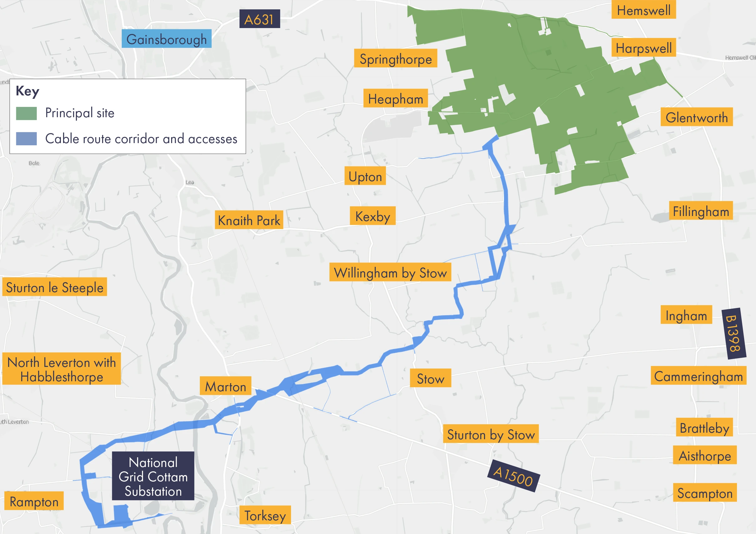
To date, we have identified the following areas, as shown in the map below:
- Principal Site – covering an area of approximately 1,400 hectares (ha), the Principal Site comprises 900 ha of developable area (where all solar PV panels and associated infrastructure would be located), and 500 ha of non-developable areas (which is being considered for environmental mitigation and enhancement measures).
- Cable Route Corridor – approximately 16 km in length the Cable Route Corridor would connect the Principal Site in West Lindsey, Lincolnshire, to National Grid’s Cottam Substation in Bassetlaw, Nottinghamshire, via underground 400 kilovolt (KV) electricity cables.
Our early stage engagement with key stakeholders, including local representatives, near neighbours and landowners, along with our initial environment surveys and design work helped shape our initial plans in these areas. We presented a more detailed design for the Scheme – the Indictive Masterplan – at our statutory consultation.
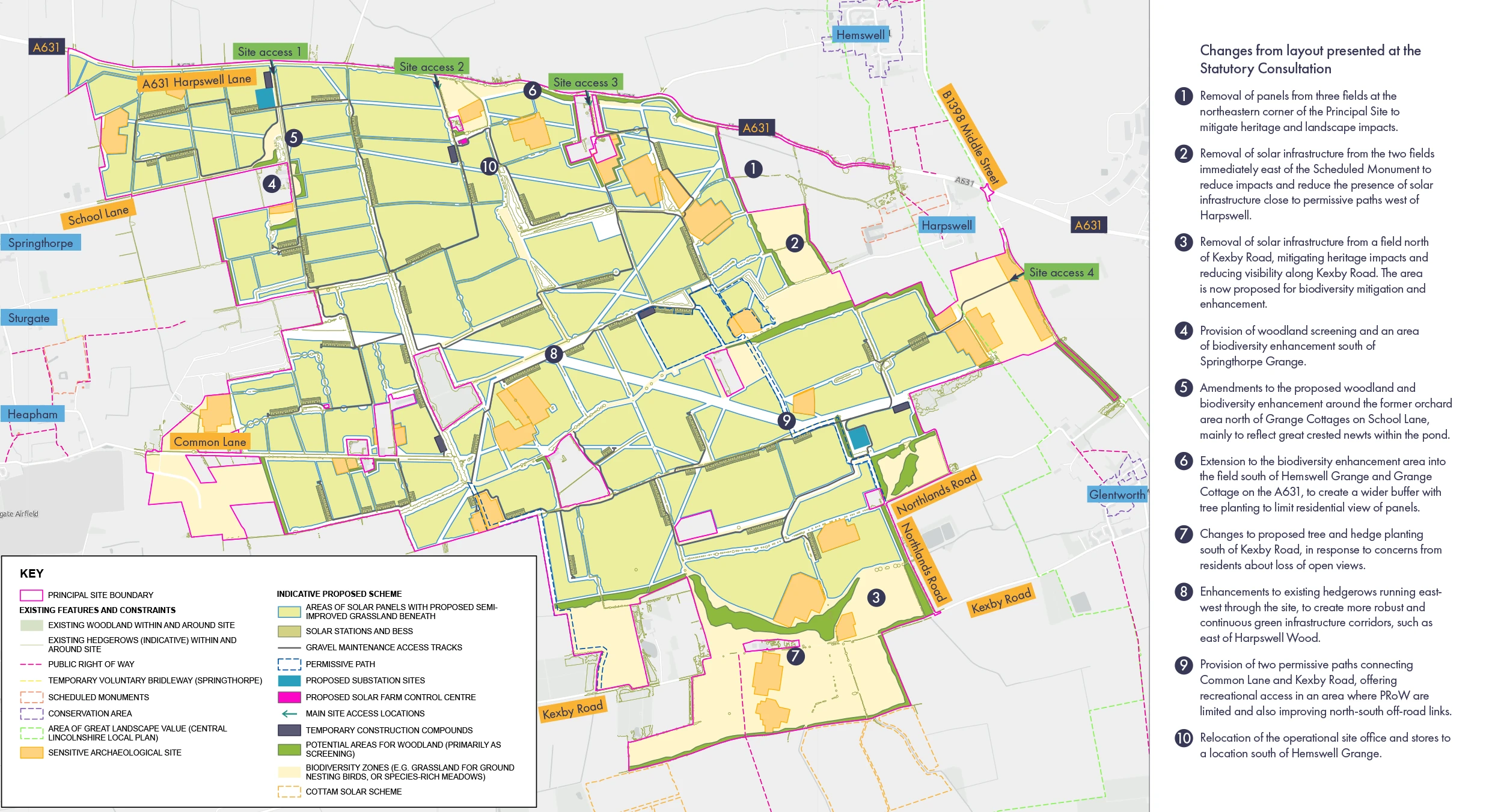
Indicative site layout plan
The indicative site layout plan below shows the proposals for the design and layout of Tillbridge Solar presented at our statutory consultation (May to July 2023). More information can be found in the Project Information Booklet, which can be found in the Documents Library.
Interactive map
For our statutory consultation we also produced an interactive map, which allows you to search for areas of interest, including explanations of the individual Scheme elements. This can be found below.
Our site
selection so far
The indicative site layout plan above shows the proposals for the design and layout of the Tillbridge Solar Principal Site. More information on this, and the site selection, can be found in the project information booklet, which can be found in the Documents Library. We will be updating this information in due course.

Our vision
Our vision for Tillbridge Solar is to deliver cleaner, greener, and lower cost energy, while also enhancing the local environment and ensuring we are a responsible developer.
Our vision and objectives